UN
3 Rugby Road
£ 575,000
Description
We don't have a Description for this property.
- Bedrooms
- 3
- Bathrooms
- 0
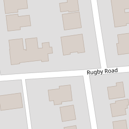

Leaflet © OpenStreetMap contributors
The heatmap indicates the level of crime in the area. The color of the heatmap indicates the crime severity and recency.
Metrics Year-on-Year
- Average area value
- 303,278.00 £Increased by 4.08 %
- Average area rental value
- 1,178.00 £/moDecreased by 4.31 %
- Est rental Yield
- 4.66 %Decreased by 8.09 %
- Crime Rate
- 5.00 %Unchanged by 0.00 %
from 291,380.00 £
from 1,231.00 £/mo
from 5.07 %
from 5.00 %
Nearby Schools
| Name | Type | Ofsted | Distance |
|---|---|---|---|
| Heene Cofe Primary School | Voluntary Aided School | Requires improvement | 1.00 KM |
| St Mary'S Catholic Primary School | Academy Sponsor Led | Good | 1.10 KM |
| Worthing High School | Academy Converter | Good | 1.13 KM |
| Thomas A Becket Junior School | Community School | Good | 1.23 KM |
| Tarring Children And Family Centre | Children's Centre Linked Site | 1.23 KM |
Images
Nearby Streets
| Name | Average Price | Average Sqft | Distance |
|---|---|---|---|
| Lansdowne Road | £ 360,000 | 0 | 0.00 KM |
| High Beeches | £ 515,000 | 0 | 0.00 KM |
| Norfolk Street | £ 0 | 0 | 0.00 KM |
| Rectory Road | £ 0 | 0 | 0.00 KM |
| Tennyson Road | £ 0 | 0 | 0.00 KM |
Nearby Transport
| Name | NLC | TLC | Distance |
|---|---|---|---|
| West Worthing | 5278 | WWO | 0.49 KM |
| Worthing | 5279 | WRH | 1.40 KM |
| Durrington-On-Sea | 5282 | DUR | 2.51 KM |
| East Worthing | 5283 | EWR | 3.78 KM |
| Goring-By-Sea | 5272 | GBS | 4.90 KM |
Nearby Listings
| Address | Price | Type | Score | Distance |
|---|---|---|---|---|
| Rugby Road, Worthing BN11 4PT | £ 365,000 | BUY | Unknown | 0.01 KM |
| Harrow Road, Worthing | £ 295,000 | BUY | 6 / 10 | 0.02 KM |
| Harrow Road, Worthing | £ 535,000 | BUY | 6 / 10 | 0.04 KM |
| Harrow Road, Worthing, BN11 4RB | £ 250,000 | BUY | 7 / 10 | 0.04 KM |
| Harrow Road, Worthing, West Sussex, BN11 | £ 250,000 | BUY | Unknown | 0.04 KM |
Nearby Properties
| Address | Price | Distance |
|---|---|---|
| 3 Rugby Road | £ 575,000 | 0.00 KM |
| 2 Rugby Road | £ 136,600 | 0.01 KM |
| 23 Harrow Road | £ 425,000 | 0.07 KM |
| 21 Harrow Road | £ 310,000 | 0.07 KM |
| 33 Harrow Road | £ 225,000 | 0.07 KM |